This pic from last years' gyro encampment is repeated from the August 2000 newsletter so that those members who receive the paper version of this newsletter will have a view of the Black Rock Desert. Those of you who can get to a browser to view the on-line version can enjoy a quick tour by clicking on the colored links, starting with a review of the August newsletter. Named for a large, prominent dark rock formation located at the north end of the desert, the Black Rock Desert is a 400 square mile silt alkaline playa, 3,848 feet above sea level, thoroughly flat and devoid of vegetation. Surrounding the desert itself are stunning landscapes. An environmental group offers advice to visitors, and reminds that envioronmentally-conscious folks will leave nothing behind, such as bent rotor blades. And if you're wondering how to get there, the rocketeers provide a set of maps. And the BLM has up-to-date information on the recent legislation affecting land use.
In last month's newsletter, I reported on my GPS, and commented that the stored
 data can be downloaded for later analysis and display. The following week
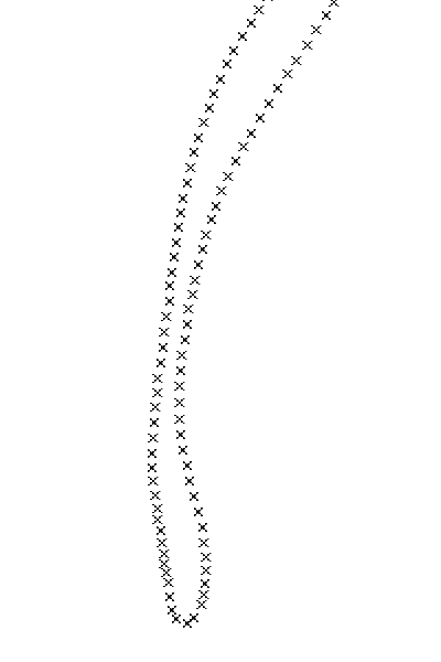
a second calibration flight produced the accompanying plot.

You can see it all. Taxi to One Four, right departure, turn west, on lookout for diversion. Let's check out the boaters down on the river. The boaters, showing better sense than some gyro pilots, were not out on this chill day. So back the other way. The overhead view shows an abrupt turn. It doesn't show the near- vertical descent with the yaw string pointing up. The hairpin width comes from the engine thrust needed for the rudder; although entry and exit legs seem to be close together, they are separated vertically by about 250 feet.. The remainder of the flight was a run to a waypoint stored a week earlier, a pass around the now nearly deserted moto-cross track, and a run back to the airport.
I had surmised that the GPS record, if downloaded before
being overwritten, could prove useful evidence, say, of safe distance being
maintained. But upon attempting to produce a 3-D plot of this flight, it became clear
that only latitude and longitude had been recorded for each fix. All other information
had been discarded. Now I can invest a few hours studying the manual and maybe
reprogram the gadget to log altitude information as well, and maybe I'll have to
get a fancier GPS before full position storage (with time stamp) is possible.
As it stands, my current system provides no evidence of safe altitude, or any altitude at all.

 After reading George's GPS adventures last
month, I immediately ordered the serial cable for my GPS. My Garmin
GPSCOM 190 doubles as my aviation radio so I've had it onboard ever
since I started flying my gyro. But now I was inspired to download
the track of where I'd been and try to plot it on a map.
After reading George's GPS adventures last
month, I immediately ordered the serial cable for my GPS. My Garmin
GPSCOM 190 doubles as my aviation radio so I've had it onboard ever
since I started flying my gyro. But now I was inspired to download
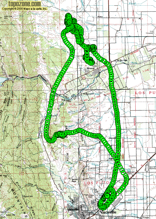
the track of where I'd been and try to plot it on a map.I found a nice topographical map of the area at www.topozone.com. Then I found some moving map software and plotted my track log on the map. The result shown here is from December 2, 2000 and shows a typical joy ride north of Vacaville, CA. As you can see I flew IFR (I Follow Roads: highway 505) northbound out of Nut Tree Airport to Winters. From there I headed west to the rolling hills. These things are wonderful; they extend for miles with few trees or other obstacles and no people. You could land pretty much anywhere out in there if your engine were to quit. The smooth hills beg you to come down low, to float from hill to hill top or drift through mini valleys, looking up at slopes on either side.
After playing around I finally head back south, this time towards Vaca Valley. Around the hill is a bare plateau. I skim this at a few feet, shooting off the end and out over the cliff and turn back around to do it again. After continuing on east I happened to spot Bob in his Bandit Pro. Turned toward him to wave, and then followed him back to the airport. You can see my downwind leg is over highway 80. Finally a couple stop-n-goes and then I called it a day.
My GPS has logged 2,750 miles since I've been flying. From now on I plan to keep my track log and post it on my web page. With some work I can plot it on a map to relive the flights on rainy days. Now all I need is to take my Gyro Cam flying to record in-flight pictures or video of my flights!
Readers of this newsletter will have noticed that my aerial comings and goings at MYV follow a right-hand pattern at a lower altitude than fixed-wing traffic. I am delighted that this separate pattern for sling-wings is not only permitted, but encouraged. An obvious advantage appears when you turn right base: with a magnificent view of other traffic, even low fast-movers on long final, you see early and avoid gracefully. And avoiding the fixed-wing downwind corridor altogether spares me the anxiety that high-speed traffic might not see my strobe till it's too late.
The rationale for flying right-hand, close-in patterns at lower altitude is clear in AC 90-66A, which states:
9. OTHER TRAFFIC PATTERNS.
Airport operators routinely establish local procedures for the operation of gliders, parachutists, lighter than air aircraft, helicopters, and ultralight vehicles. Appendices 2 and 3 illustrate these operations as they relate to recommended standard traffic patterns.
a. Rotorcraft.
Bear in mind, however, that until a written procedure is in
hand, flying opposite to prevailing traffic may well leave one vulnerable
to over-zealous enforcement.
 PRA Chapter 5 Newsletters are also available on-line at:
http://www.quiknet.com/~twitham/gyro/pra5/